

Interactive Time-Lapse Map Shows How the U.S. Took More Than 1.5 Billion Acres From Native Americans

This interactive map, produced by University of Georgia historian Claudio Saunt to accompany his new book West of the Revolution: An Uncommon History of 1776, offers a time-lapse vision of the transfer of Indian land between 1776 and 1887. As blue “Indian homelands” disappear, small red areas appear, indicating the establishment of reservations. (Above is a GIF of the map’s
Read more


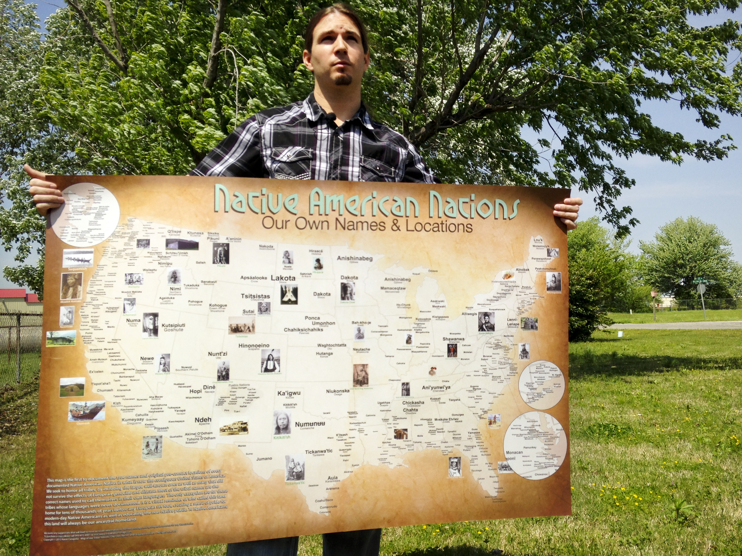 Aaron Carapella, a self-taught mapmaker in Warner, Okla., has pinpointed the locations and original names of hundreds of American Indian nations before their first contact with Europeans. As a teenager, Carapella says he could never get his hands on a continental U.S. map like this, depicting mor…
 “the history of Indian boarding schools needs to be brought to the forefront of our collective consciousness in the United States” Click through to read more.
 Google’s approach to email
 The Board ruled that the name was “disparaging to Native Americans” and could not receive trademarks under federal law.
 Native Hawaiian founds Hawaiian Boarding Company
You must be logged in to post a comment.